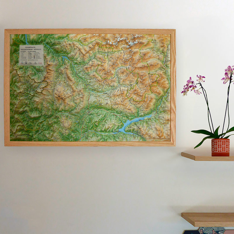
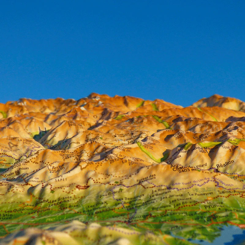
The must-have 3D relief map of the Hautes-Alpes
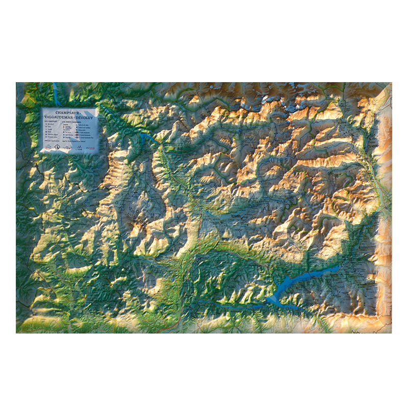
This relief map presents the Champsaur – Valgaudemar – Dévoluy region. Located in the heart of the Hautes-Alpes, it guides you through these iconic mountain ranges, between preserved valleys, majestic peaks and renowned mountain routes. You will notably find paragliding sites, as well as numerous tourist and natural highlights.
> Discover the map in more detail by clicking here.
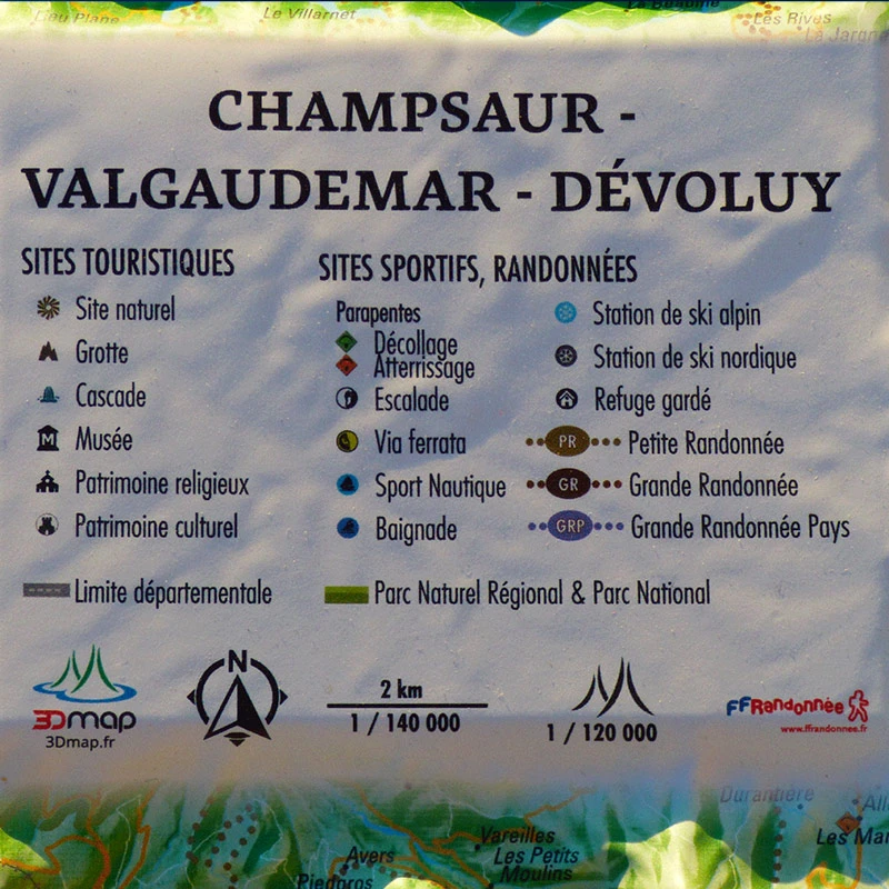
Tourist sites:
- Natural site
- Cave
- Waterfall
- Museum
- Religious heritage
- Cultural heritage
Sports sites and hiking:
- Long-distance hiking trail (GR)
- Short-distance hiking trail (PR)
- Regional long-distance hiking trail (GRP)
- Water sports
- Swimming area
- Alpine ski resort
- Nordic ski resort
- Staffed mountain hut
- Via Ferrata
- Climbing site
- Paragliding site (https://federation.ffvl.fr/)
- Take-off
- Landing
- Airfield
3D Map: French relief maps
The 3DMap brand maps represent a true renewal in the world of relief cartography. The result of extensive research and development, they offer remarkable precision and finishing quality. Created by two brothers from the Vaucluse region and passionate about geography, 3DMap maps highlight the cultural, sporting and tourist heritage of French regions.
For optimal presentation, it is possible to add a frame to your relief map (available in 3 colors).
Please note that Air et Aventure also offers many other relief maps from the 3DMap brand. Feel free to discover them!
Read moreShow less


