Click for more products.
No produts were found.
Click for more products.
No produts were found.
Welcome

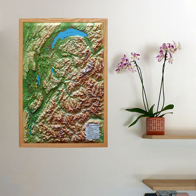
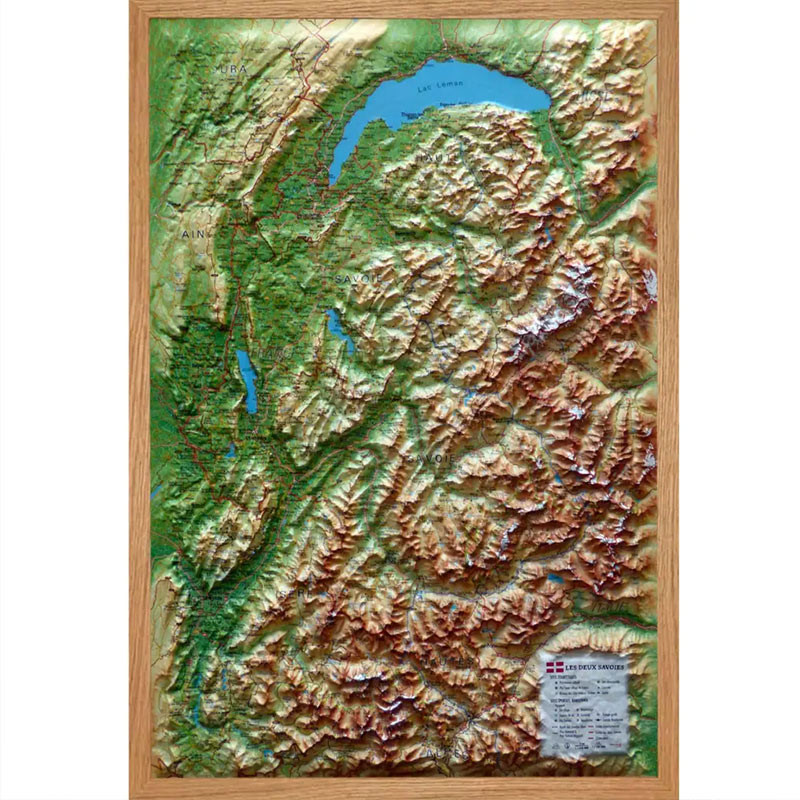
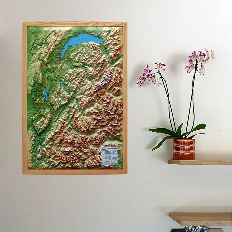
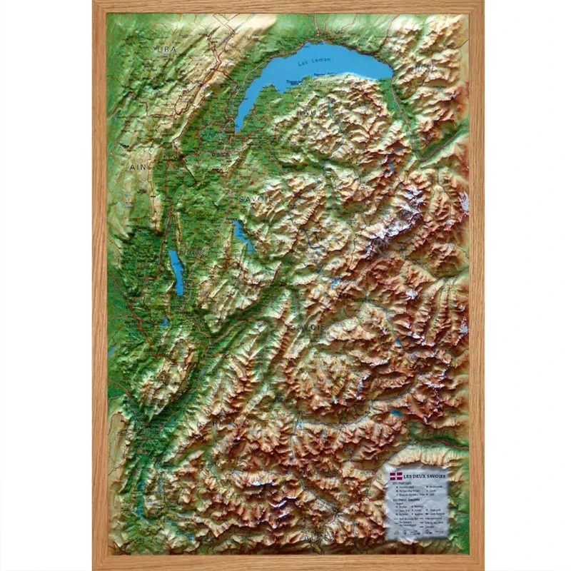
3DMap Relief Map of Savoie and Haute-Savoie

A relief map of Savoie and Haute-Savoie

Discover the relief map of Savoie and Haute-Savoie. Made by 3DMap, it highlights the terrain, territorial boundaries, as well as many tourist, sports and natural sites across Savoie and Haute-Savoie.

Dimensions (mm): 608 x 408

Planimetric scale: 1 : 195 000

Altimetric scale: 1 : 360 000

Read moreShow less
£34.09 (tax incl.)
In stock, immediate delivery!
Quantity
Close
Reference:
0505
Description

A relief map to explore Savoie and Haute-Savoie

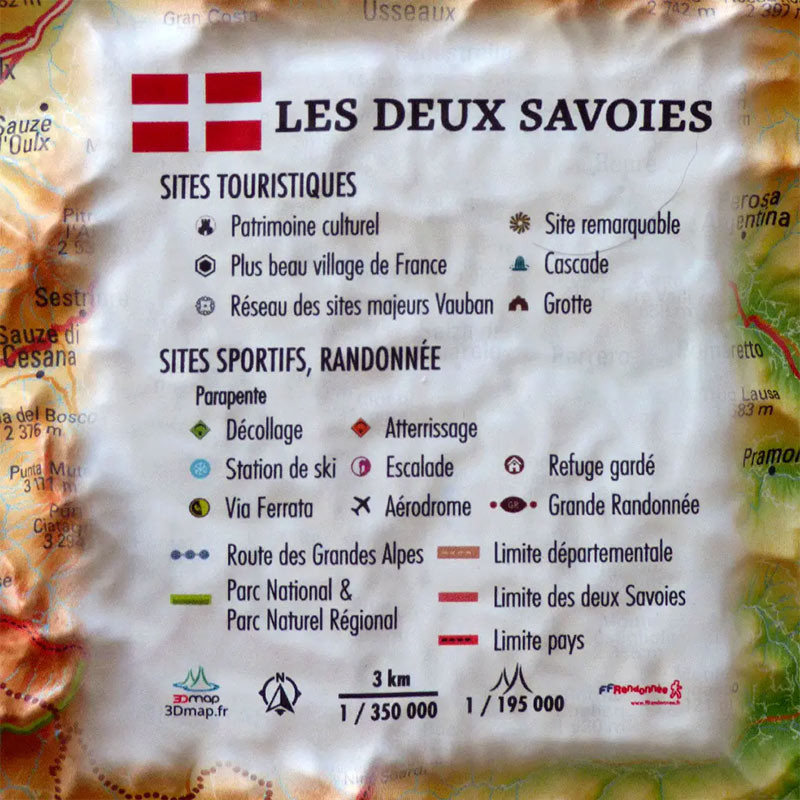
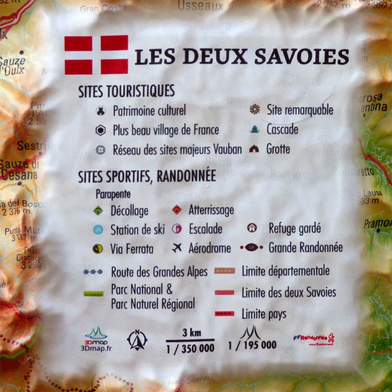
Discover the relief map of Savoie and Haute-Savoie by 3DMap. It provides a clear view of the region, including its terrain, departmental boundaries, the boundary between Savoie and Haute-Savoie, and national borders. Thanks to the wealth of information displayed, this map offers a clear overview of the region’s tourist, natural, sports and hiking sites.

It includes the following information:

  • Cultural heritage
  • The most beautiful villages in France
  • The Network of Major Vauban Sites
  • Remarkable sites
  • Waterfalls
  • Caves
  • Paragliding sites
  • Take-off sites
  • Landing sites
  • Ski resorts
  • Via Ferrata sites
  • Climbing sites
  • Staffed mountain huts
  • Airfields
  • Long-distance hiking trails (GR)
  • The Route des Grandes Alpes
  • National Parks and Regional Natural Parks
  • Departmental boundaries
  • The boundary between Savoie and Haute-Savoie
  • National borders

A 100% French relief map:

3DMap maps offer significantly higher print quality than older relief maps. This is the result of extensive R&D and French design expertise.

In addition, dedicated 3D processing software has been specifically developed to enable wider use of geographical information, including bathymetric data.

For an even better presentation, complete your relief map with a suitable frame (available in 4 colours).

Air et Aventure also offers many other relief maps by 3DMap. Feel free to discover them!

Read moreShow less

Product Details
0505

Data sheet

Type of map
Map
Type of products
RELIEF MAP
Related products
Kortel Cap Kortel Cap
£18.79 (tax incl.)
A cap for every situation Designed by the Kortel paragliding brand, this versatile cap is just as suitable for your sporting activities as it is for everyday wear. With its colorful yet clean design, it adds a...
In stock, immediate delivery!
Wood frame for relief maps 430x630 mm 3DMap Wood frame for relief maps 430x630 mm 3DMap
(2 reviews)
£30.67 (tax incl.)
A frame to enhance your relief map This stylish wooden frame is ideal for 3DMap embossed maps. Color: White / Black / Wood  Dimensions (cm): 43 x 63 Width (mm) : 15 Thickness (mm) : 30
In stock, immediate delivery!
Vol-rando in France Vol-rando in France
£20.50 (tax incl.)
Vol-rando in France: topo-guide to the most beautiful flights Discover the most beautiful vol-randos in France. From the Corsican coast to the magnificent mountain pastures of Haute-Savoie, via the dormant volcanoes...
Out of stock
Niviuk Bonnet Niviuk Bonnet
(1 review)
£17.09 (tax incl.)
Cold Should Not Be a Barrier to Your Aerial Adventures Wherever you go, the new Niviuk beanie is ideal for protecting you from low temperatures. Soft and comfortable, it is perfect for all your paragliding outings or...
On order

Settings

Menu